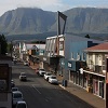
NATIONAL NEWS - Strong winds in various parts of the country are bringing with them raging fires for some and heavy rain and disruptive snow for others.
Earlier today, the Western Cape Government’s Provincial Disaster Management Centre (PDMC) said it had received reports from various districts and departments after the first of several intense cold fronts made landfall over the weekend.
“Widespread disruptions and damages, including loss of shelter in informal settlements, localised flooding, fallen trees, electricity outages, and road closures due to snow or flooding, were reported during our meeting today.
“The City of Cape Town, Overberg, Cape Winelands, and West Coast Districts were hardest hit by the severe weather. As always, our focus remains on the safety of our residents and the humanitarian support that they need,” said Anton Bredell, Western Cape MEC for Local Government, Environmental Affairs and Development Planning.
Bredell said the provincial government is working with the City of Cape Town and the National Department of Human Settlements to address the immediate needs of people who lost their homes during the storms.
Significant rainfall was recorded yesterday and today, with Ceres receiving 123mm and Elgin Grabouw 84mm. Observatory in Cape Town recorded 47mm, and Stellenbosch 68mm.
The South African Weather Service (SAWS) provided an update on what can be expected from today until Friday.
A series of cold fronts are on track to make landfall, resulting in a week of wet and cold conditions.
Today saw the coldest expected daytime temperatures. The next cold front with rain is expected to arrive tomorrow.
Between 10mm and 20mm of rain is expected over the western parts of the province, and between 40mm and 60mm can be expected over the south-west mountains. “We are concerned about the rain-on-rain scenario, as saturated soil could lead to rock falls, landslides and flash floods,” Bredell said.
SAWS confirmed its outlook for strong to gale force west- to north-westerly winds for the south-west coast and emphasised the high danger of runaway wildfires in the Garden Route District.
The Department of Water and Sanitation continues to monitor river and dam levels, which are expected to rise significantly in the coming week.
The PDMC will support several search-and-rescue operations to communities currently cut off from main access roads.
“Wuppertal and other communities in the Cederberg area will be reached by specialised 4×4 teams once a needs assessment has been conducted, and we will be ready for similar requests as the week unfolds,” Bredell said.
Eskom reported several outages over the past 48 hours caused by the severe weather. Cape Town, the West Coast and Overberg regions were hardest hit, and repair teams are attending to them as fast as possible.
Weather warnings in place
An orange level 5 warning for heavy snow has been issued by SAWS for the Eastern Cape from today until Thursday:

A yellow level 2 warning for disruptive snow has been issued for the southern areas of the Northern Cape and the eastern parts of the Free State for today:

SAWS has also issued warnings for more damaging winds and waves:


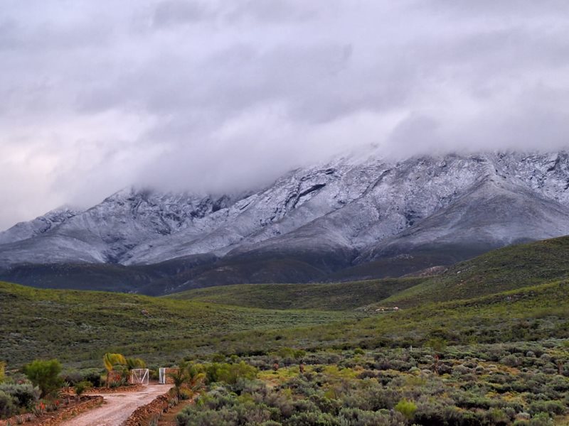
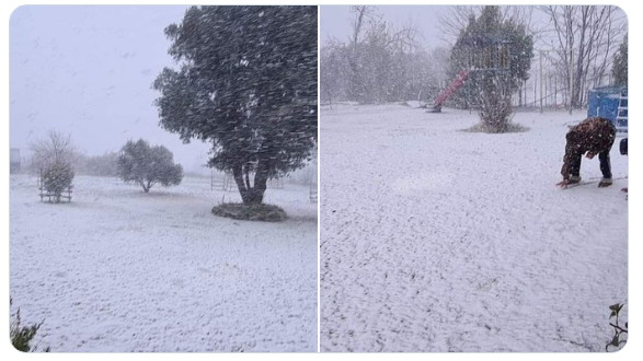
Many have taken to social media to share their photos of the snow over the past few days:
Swartberg Mountain range, De Rust. Photo: Naomi van der Westhuizen

‘We bring you the latest Garden Route, Hessequa, Karoo news’