GARDEN ROUTE & KAROO NEWS - Severe thunderstorms are expected over Gauteng, eastern parts of the North West as well as the central and southern areas of Mpumalanga on Thursday, 25 September, according to the South African Weather Service.
Weather warnings:
A. Yellow level 2: Disruptive rainfall with heavy downpours resulting in localised flooding of roads and settlements and damage to infrastructure over the extreme northeastern parts of KwaZulu Natal.
B. Yellow Level 2: Severe thunderstorms with damaging winds, large amounts of small hail and heavy downpours resulting in localized flooding and damage to settlements, properties and roads are expected in place over the Mpumalanga Highveld, Gauteng and the northeastern parts of North West Province.
Fire danger warnings
Extremely high fire danger conditions are expected over the Richtersveld District Municipality of the Northern Cape.

Regional forecast:
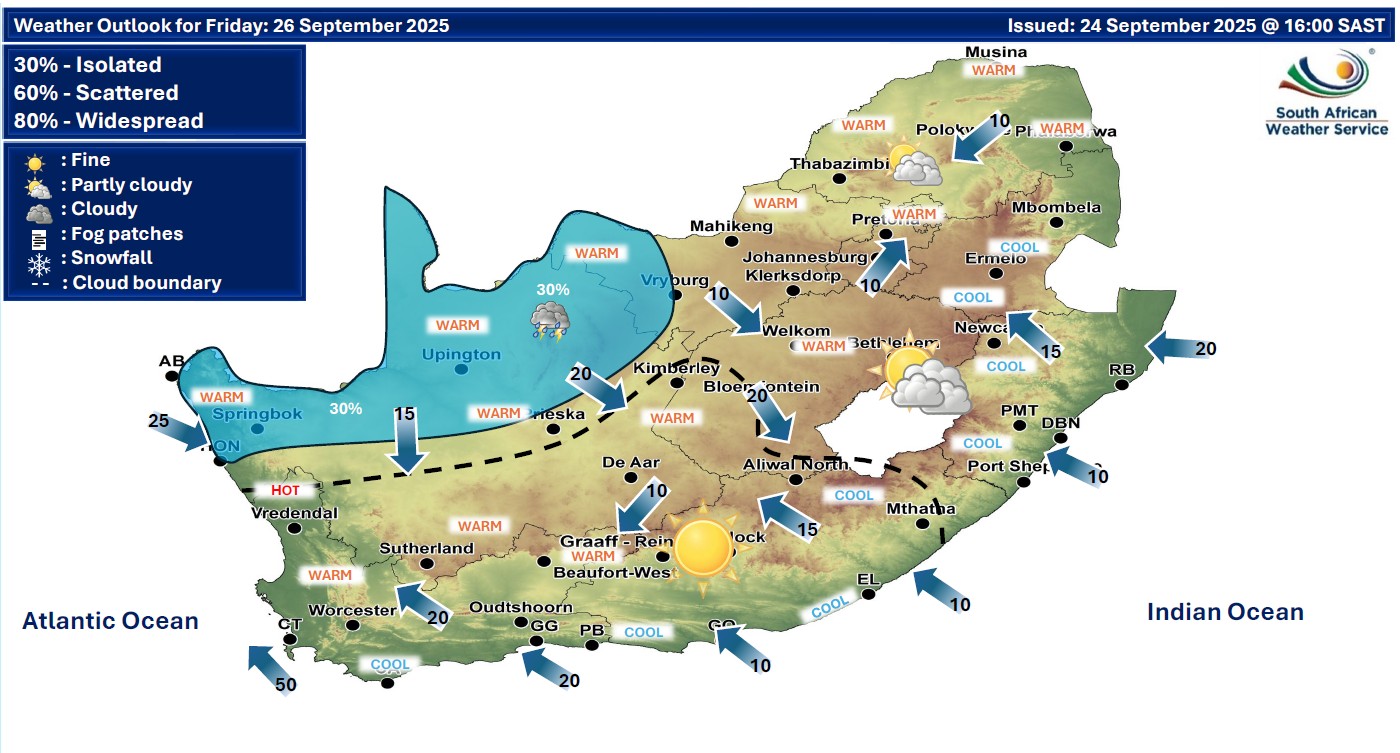
Western Cape
Fog patches over the Little Karoo in the morning, otherwise fine and cool, but warm along the West Coast. The wind along the coast will be light north-westerly along the south coast in the morning and evening, otherwise moderate to fresh south to south-easterly, but strong along the west coast from the afternoon.
The expected UVB sunburn index: High
Western half of the Eastern Cape
Fog patches in places over the interior at first, otherwise partly cloudy and cool, becoming fine from late morning. The wind along the coast will be light and variable.
Eastern half of the Eastern Cape
Cloudy with isolated showers and rain in places in the east at first, otherwise partly cloudy and cool, becoming fine in places from the afternoon. The wind along the coast will be light and variable.


Extended weather forecast:

‘We bring you the latest Garden Route, Hessequa, Karoo news’