


GARDEN ROUTE NEWS - The South African Weather Service (SAWS) says a surface trough will remain semi-permanent over the western interior of the country this week, while a surface high-pressure system extends its ridge into the southern and eastern parts.
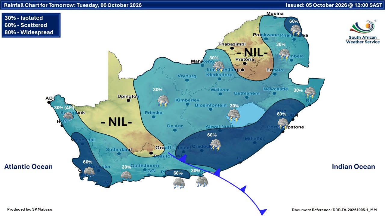
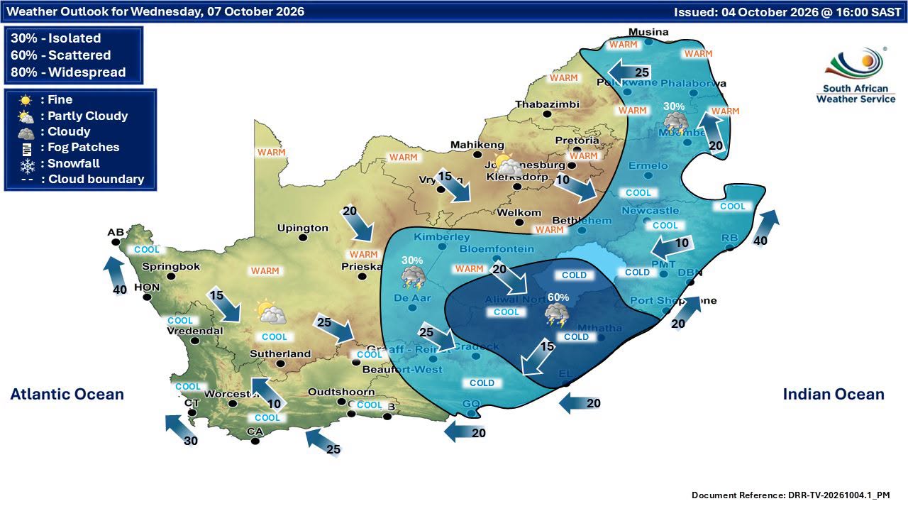
The weather pattern is expected to result in isolated to scattered showers and thundershowers in places over the south and east.
On Monday, conditions are expected to be partly cloudy, windy and cool to warm, with isolated showers and thundershowers in places.
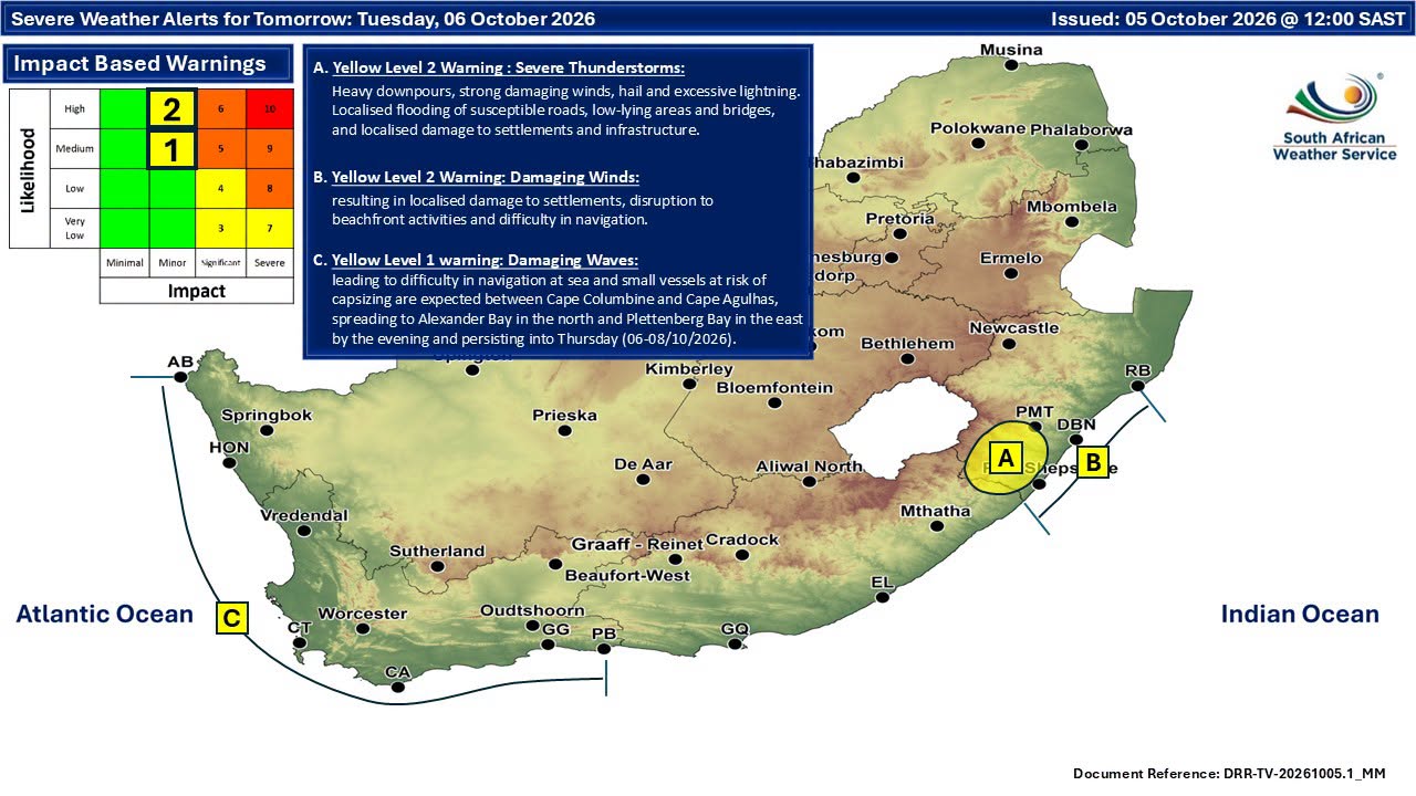
SAWS has issued a Yellow level 1 warning for damaging waves leading to difficulty in navigation at sea and small vessels at risk of capsising are expected between Cape Columbine and Cape Agulhas from Tuesday until Thursday, spreading to Alexander Bay and Plettenberg Bay by Tuesday evening, 6-8 October.
Members of the public and stakeholders are strongly urged to continuously monitor official SAWS forecasts and warnings, which will be updated as the likelihood and severity of potential impacts become clearer.
The public is also advised to remain cautious of unauthorised or unverified weather information and to refrain from sharing such information further. -SAnews.gov.za
‘We bring you the latest Garden Route, Hessequa, Karoo news’