GARDEN ROUTE | KAROO NEWS - South Africa’s coastal and interior regions are bracing for severe weather disruptions on Friday and into the weekend.
The SA Weather Service (Saws) issued several level 4 yellow warnings.
Here’s what you need to know:
Weather alerts for 28 July
Saws warn of likely interference with beachfront activities and navigational difficulties at sea from Alexander Bay to Cape Point.
Meanwhile, the City of Cape Town and Cape Winelands was issued with a level 4 warning as well, cautioning against heavy rainfall which could potentially flood roads and settlements.
The eastern regions of the Northern Cape, along with the southern parts of the Free State Provinces, have been warned of damaging winds that may disrupt agricultural activities.
The yellow level 1 warning cautions against localised damage to both formal and informal settlements.
A cold snap
An intense low-pressure system is expected to hit land on Friday evening, dramatically reducing daytime temperatures over the weekend.
Temperatures may dip below 10 degrees Celsius in the interior of Namakwa Region of the Northern Cape Province and over the interior of the Western Cape Province.
The general public and small stock farmers are advised to prepare for general windy, cold, and wet conditions, accompanied by snowfall over the mountainous areas.
Fire advisories
Several regions across the southern parts of South Africa are under extremely high fire danger conditions, including:
- Beaufort West Municipality in the Western Cape
- North-eastern parts of the Northern Cape
- Western parts of the North-West
Provincial weather forecasts
- Gauteng, Mpumalanga, and Limpopo can anticipate fine and cool to warm weather.
- Northern Cape is expected to experience fog in the morning, while Western Cape is likely to experience light rain, spreading to the north and central interior by evening.
- The Eastern Cape is set to have a mix of weather conditions, with morning fog in some places and windy conditions in others.
- In the Free State, cool to warm conditions are expected, which will become partly cloudy over the central and western parts in the afternoon.
- It will be windy in the central and western parts. Meanwhile, KwaZulu-Natal is expected to enjoy fine and warm weather.
The Cape Town Weather Office has issued further impact-based warnings for the Western Cape and Namaqua Region of Northern Cape as follows:
Damaging Waves (Level 5)
- Areas affected: Bitou, George, Hessequa, Knysna and Mossel Bay
Disruptive Rain (Level 4)
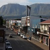
- Areas affected: Kannaland and Oudtshoorn
Disruptive Snow (Level 4)
- Areas affected: Kannaland and Oudtshoorn
Disruptive Rain (Level 6)
- Areas Affected: Bitou, George, Hessequa, Knysna and Mossel Bay
Report weather-related incidents to the Garden Route Emergency Centre at 044 805 5071
‘We bring you the latest Garden Route, Hessequa, Karoo news’