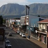
GARDEN ROUTE | KAROO NEWS - After a mostly sunny day, the South African Weather Service has issued a Yellow Level 1 warning for damaging waves along the coastline.
The South Atlantic high pressure system will result in strong to near gale force (39-61km/h) easterly to south-easterly winds between Cape Point and Cape Agulhas from tonight, Wednesday 6 November.
Coupled with the winds, significant south-westerly waves with heights of 4 to 5m are expected.
These conditions will be spreading along the south coast to Plettenberg Bay during Thursday evening and persisting until Friday morning.
Small vessels are advised to seek shelter in harbours, bays or inlets. Monitor weather update and sea conditions closely.
Here is your expected weather on Thursday:
Western Cape:
Fine, and warm to hot conditions, but very hot in places over the interior of the West Coast.
The wind along the coast will be strong south-easterly reaching near gale force in the south-west, otherwise fresh easterly along the south coast becoming strong from the afternoon.
The expected UVB sunburn index: Extreme.
Eastern Cape (western half):
Partly cloudy and cool near the coast, otherwise fine and warm.
The wind along the coast will be light to moderate easterly
Eastern Cape (eastern half):
Cloudy to partly cloudy south of the escarpment, with a chance of light evening drizzle and rain in the extreme south-east.
The wind along the coast will be light to moderate easterly.
Expected temperatures:
- Oudtshoorn 8|25 SE 9 Clear skies
- Riversdale 9|23 ESE 19 Partly cloudy - Clear skies
- Mossel Bay 11|20 ESE 19 Partly cloudy - Clear skies
- George 11|20 ESE 19 Partly cloudy - Clear skies
- Knysna 13|22 ESE 19 Partly cloudy - Clear skies
- Graaff-Reinet 20|30 SE 9 Clear skies
‘We bring you the latest Garden Route, Hessequa, Karoo news’