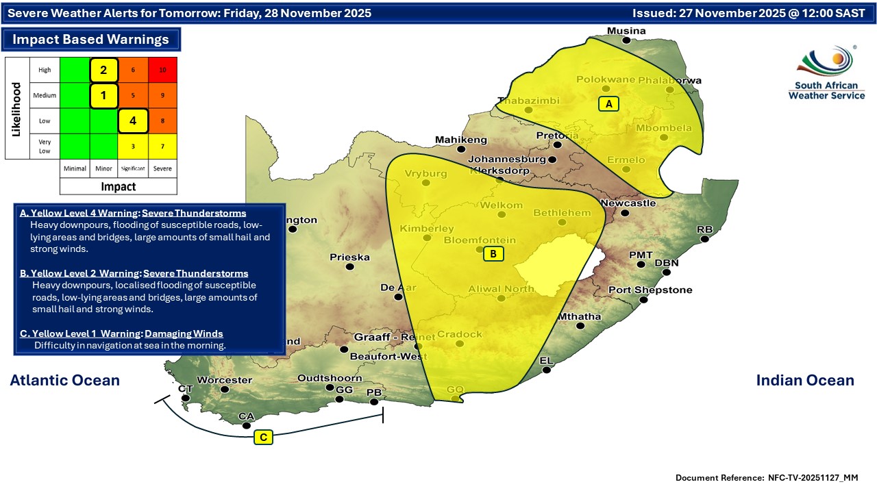
GARDEN ROUTE | KAROO NEWS - In today's weather forecast, a yellow level 1 warning for damaging coastal winds leading to difficulty in navigation at sea is expected between Table Bay and Plettenberg Bay until early Friday morning.
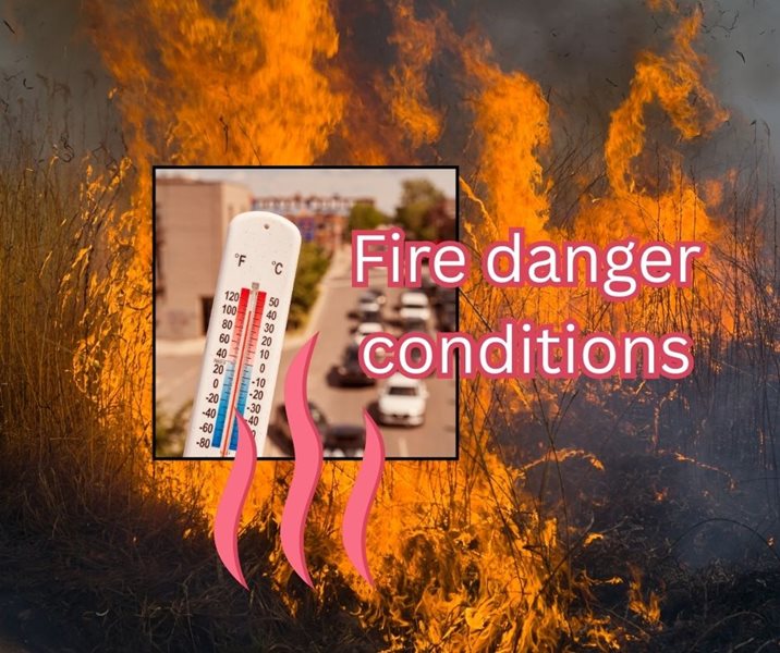
Fire danger warning:
Extremely high fire danger conditions are expected over the Nama Khoi, Khai-Ma, Hantam Karoo and Karoo Hoogland municipalities (N.Cape) today, including the Central Karoo.
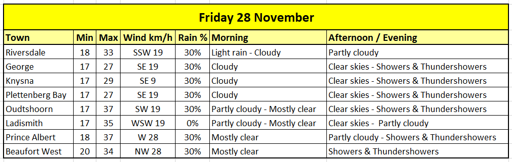
Weather forecast for today, Friday 28 November
Western Cape
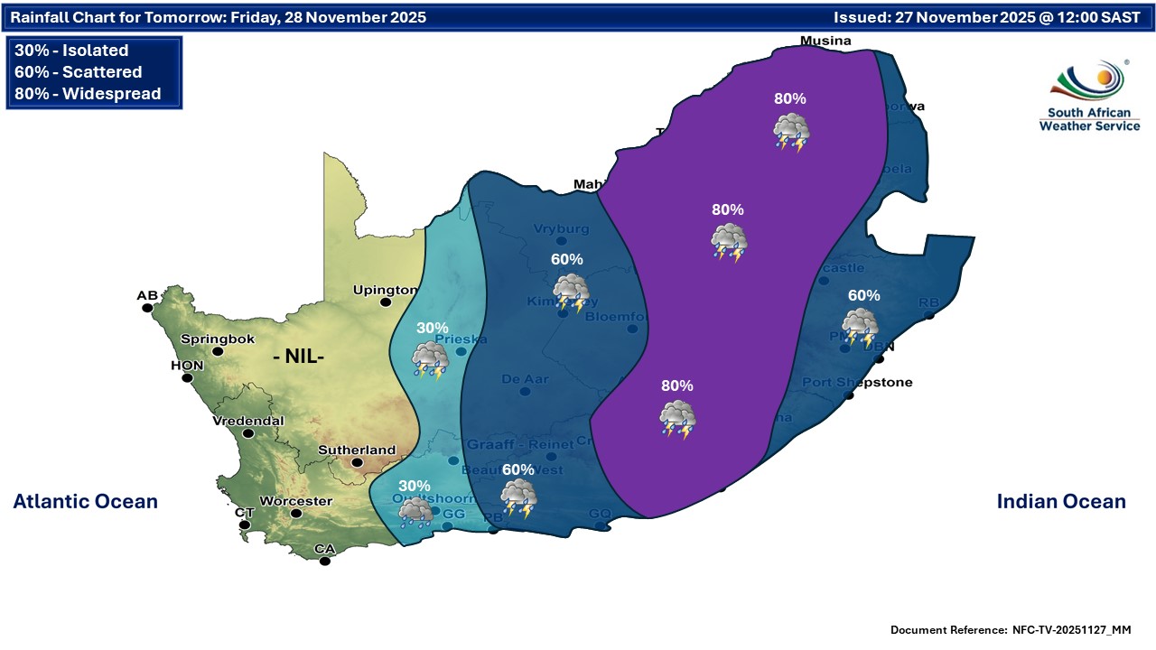
Cloudy and warm along the west and south coast in the morning and evening, otherwise partly cloudy and hot to very hot, with isolated afternoon showers and thundershowers in the extreme eastern parts.
The wind along the coast will be strong to near gale, easterly to south-easterly along the south coast in the morning, otherwise moderate to fresh north-westerly to westerly. It will become fresh to strong south-westerly in the evening.
The expected UVB sunburn index: Very High
Western half of the Eastern Cape
Very hot in places over the interior, otherwise partly cloudy and warm to hot with widespread showers and thundershowers.
The wind along the coast will be fresh to strong easterly
Eastern half of the Eastern Cape
Partly cloudy and warm to hot with scattered showers and thundershowers, but widespread in the north-west. The wind along the coast will be fresh to strong north-easterly.
Expected temperatures for today:
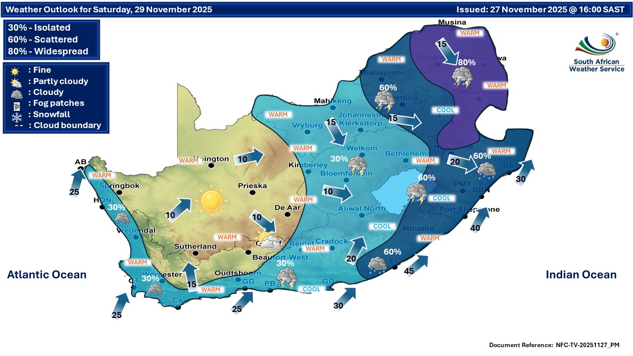
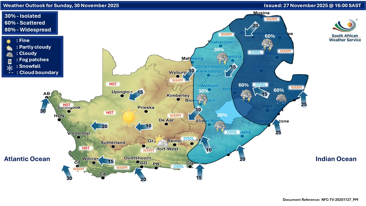
Extended weekend forecast:
‘We bring you the latest Garden Route, Hessequa, Karoo news’