GARDEN ROUTE | KAROO NEWS - Extremely high fire danger conditions are expected over the central parts of Northern Cape, the northern parts of the Western Cape and in places over the western parts of the Eastern Cape.
The South African Weather Service (Saws) has issued a yellow level 1 warning for damaging coastal winds between Table Bay and Plettenberg Bay from Thursday late morning until Friday afternoon.
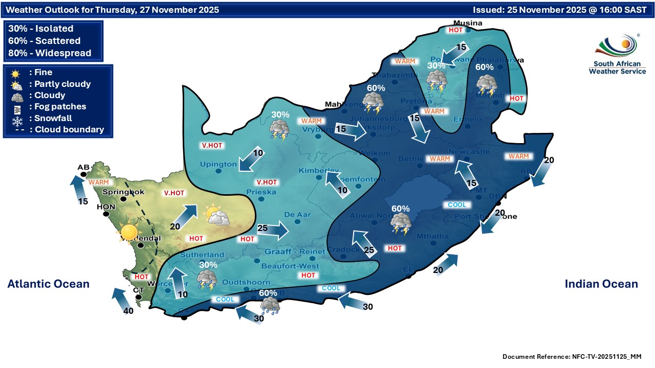
Regional weather forecast for Wednesday 26 November:
Western Cape
Partly cloudy over the southern parts, otherwise fine and warm to hot but very hot in places. It will be cool along the south coast and adjacent interior with light rain.
The wind along the coast will be light and variable east of Cape Agulhas becoming moderate to fresh southerly to south-easterly from the afternoon, but moderate to fresh north-westerly north of Cape Columbine, otherwise fresh to strong south-easterly reaching gale at times near Cape Point.
The expected UVB sunburn index: Very High
Western half of the Eastern Cape
Fine and hot to very hot, becoming partly cloudy and windy in places over the interior, with isolated thunderstorms over the northern parts. It will become cloudy along the coast in the evening with light rain in places.
The wind along the coast will be light to moderate north-easterly east of St Francis at first, otherwise light north-westerly, becoming moderate to fresh south-westerly in the afternoon.
Eastern half of the Eastern Cape
Fog in places at first, otherwise fine and hot to very hot, becoming partly cloudy with isolated thunderstorms in the north and east.
The wind along the coast will be light north-easterly at first, otherwise moderate easterly.

Expected temperatures for today:

Extended weather forecast:
‘We bring you the latest Garden Route, Hessequa, Karoo news’