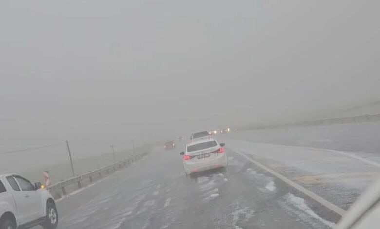
NATIONAL NEWS - Battered and bruised is not only used to describe the bodies of Welsh rugby players after a thumping by the Springboks on Saturday. It can also be used to describe the aftermath of massive hail that was reported in parts of South Africa last night.
Social media has been flooded with videos and photos of the hail in all shapes and sizes: From golf ball-sized to thick, unmelted heaps on roads.
Most of the hail was reported in Gauteng, including in Sinoville, Benoni and Kempton Park, while Middelburg Observer reports that a heavy hailstorm affected the N4 in Sunbury near Belfast in Mpumalanga.
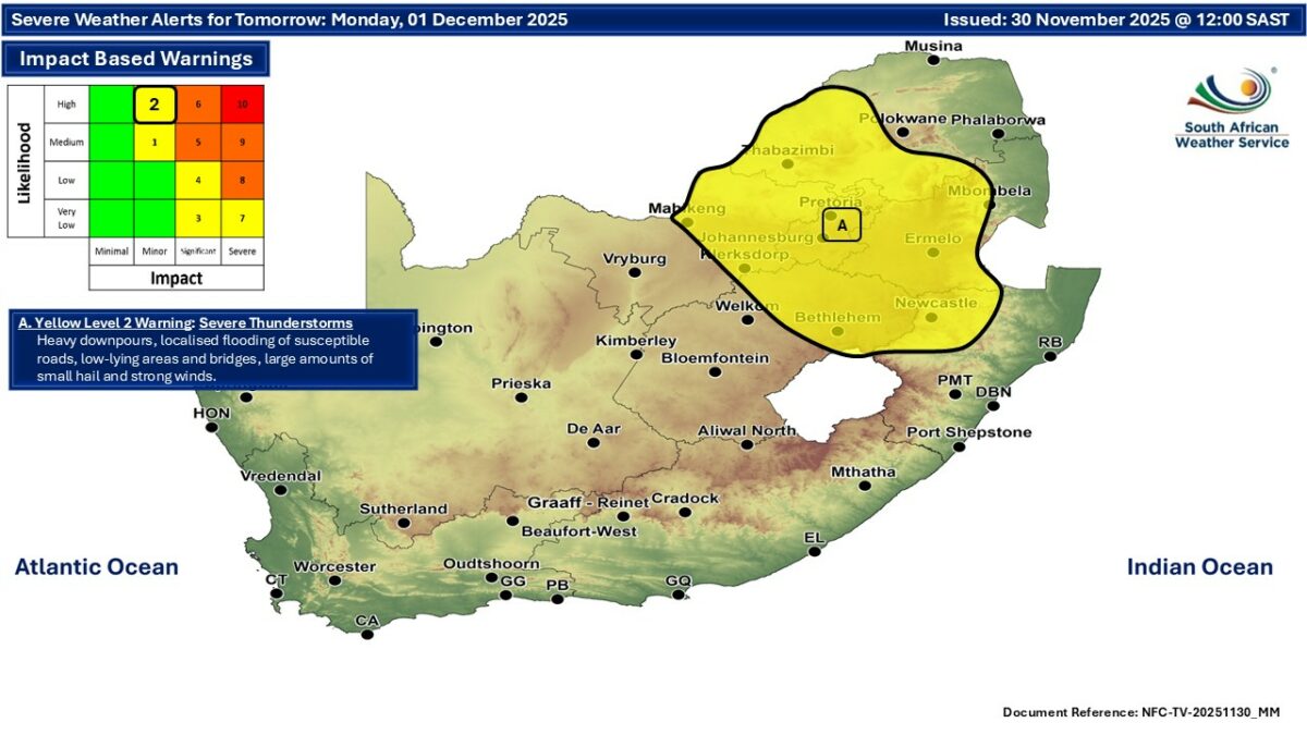
This morning, South African Weather Service (SAWS) meteorologist Lehlohonolo Thobela confirmed to Caxton Network News that the hail was part of the severe weather predicted in a SAWS warning issued yesterday.
The warning stated that severe thunderstorms with a likelihood of heavy rain, localised flooding, damaging winds, the possibility of hail and excessive lightning could occur in parts of Gauteng, Limpopo and Mpumalanga.
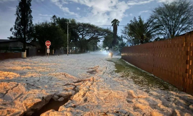
 A hailstorm affects traffic on the N4 near Belfast. Photo: Supplied
">More pics: FB https://t.co/Qrv0TsxLfd pic.twitter.com/tJcKvaIvMp
— Yusuf Abramjee (@Abramjee) December 1, 2025
Forecast
The weather service’s travellers’ forecast for today notes a yellow level 2 warning for severe thunderstorms. Heavy downpours, which could cause localised flooding of susceptible roads and low-level bridges, are expected, along with strong winds and the possibility of large amounts of hail. Affected areas include Gauteng, the Highveld and escarpment of Mpumalanga, south-western parts of Limpopo, eastern parts of the Free State and the North West, and north-western parts of KZN.
Meanwhile, extremely high fire danger conditions are expected over the south-western parts of the Northern Cape and the western parts of the Western Cape.
‘We bring you the latest Garden Route, Hessequa, Karoo news’