GARDEN ROUTE | KAROO NEWS - The mid-summer season started off with above-normal rainfall over almost the entire country during December 2021 (Figure 1).
These rainfall conditions continued into the first twenty days of January 2022 (Figure 2 and 3) over the larger part of the country, with the exception of most of the coastal regions.
The wetter than normal summer rainfall season so far can mostly be ascribed to the presence of the current La Niña event.
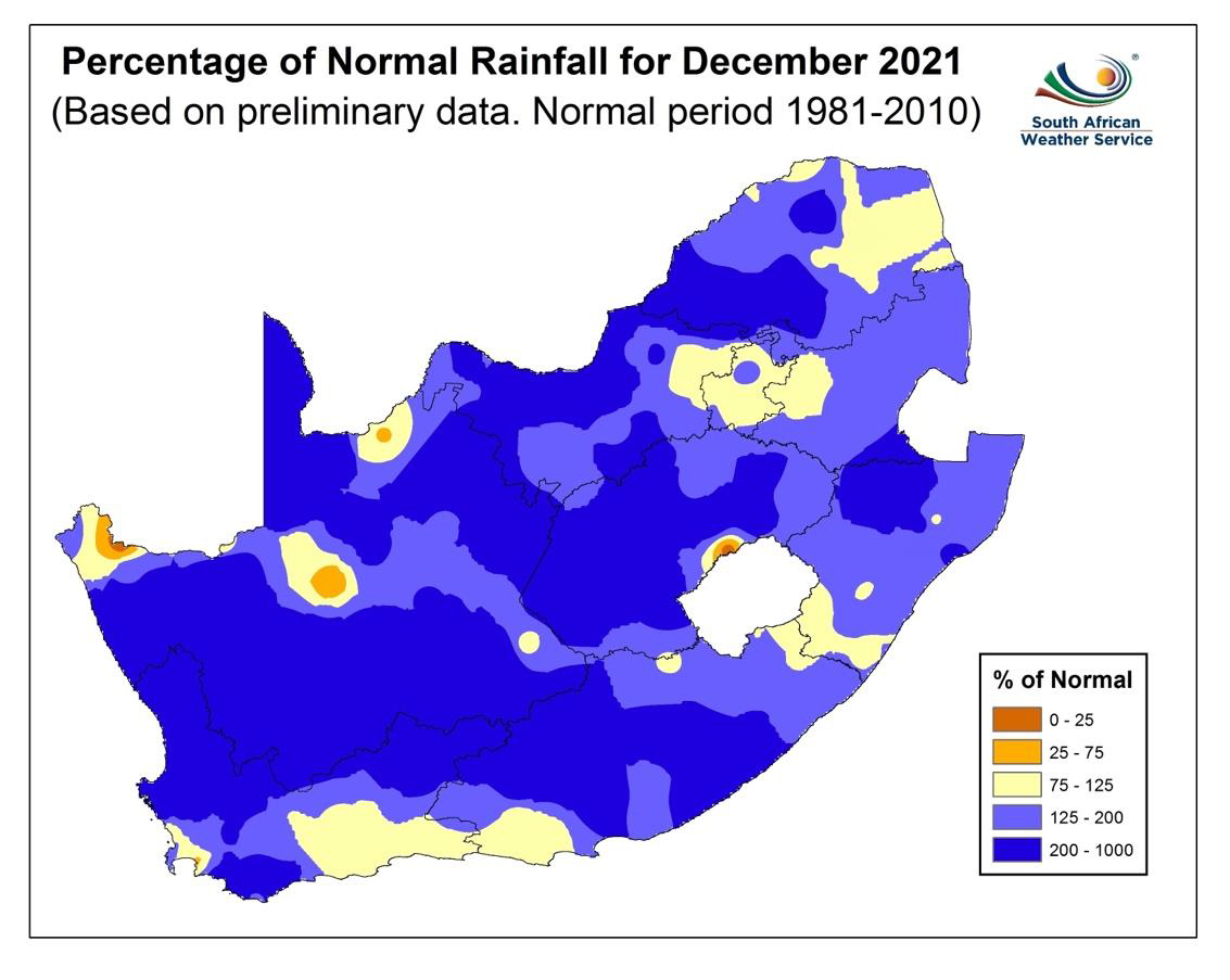 Figure 1
Figure 1: Percentage of normal rainfall for December 2021. Blue shades are indicative of above-normal rainfall and the darker yellow shades of below-normal rainfall.
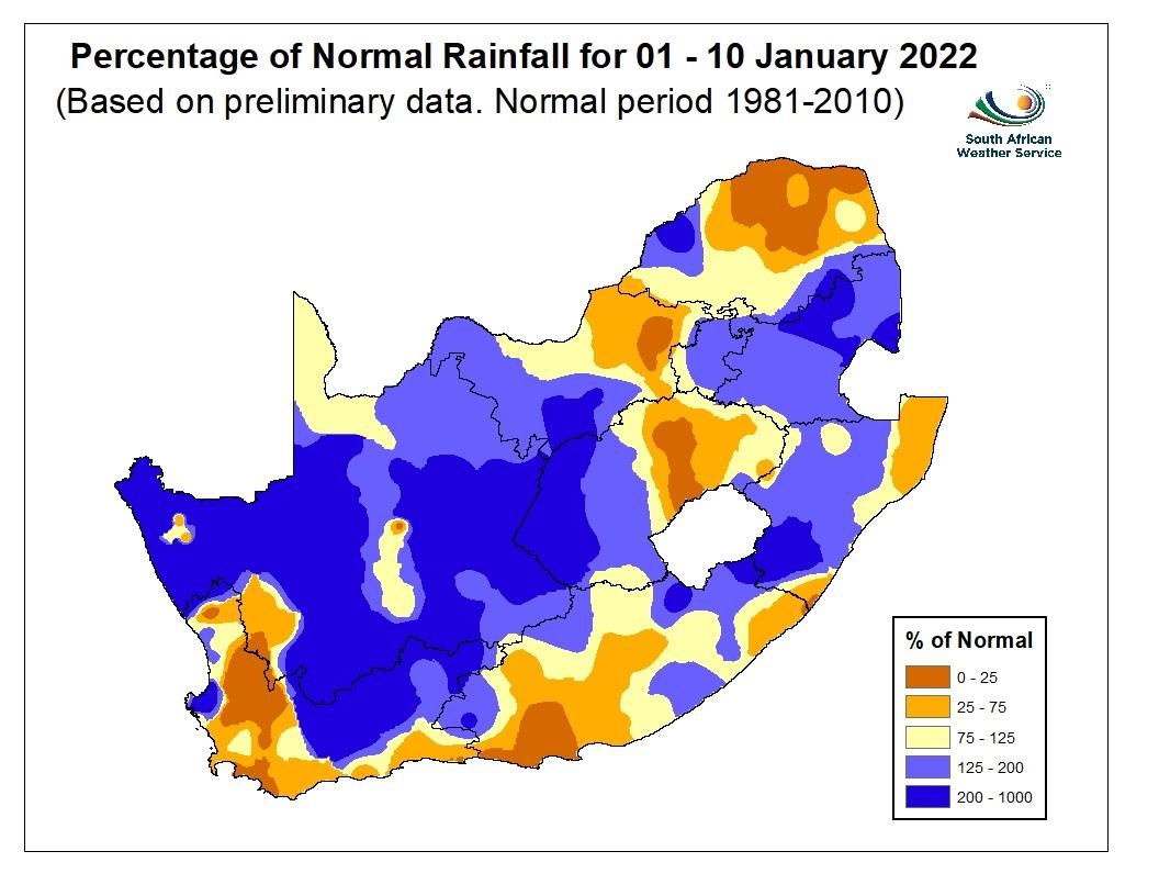 Figure 2
Figure 2: As for Figure 1, but for the first ten days of January 2022.
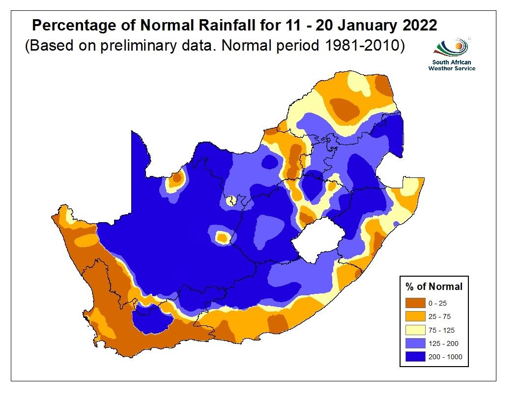 Figure 3
Figure 3: As for Figure 2, but for the second ten days of January 2022.
The current La Niña event is predicted to weaken towards the end of the summer season and ENSO neutral conditions are expected to set in during autumn.
In the most recent set of seasonal rainfall predictions (both locally and internationally), the expected rainfall over South Africa for the remainder of this summer indicates enhanced probabilities for below-normal rainfall over the summer rainfall region, except over parts of the eastern interior, where the predicted rainfall outcome is uncertain (Figure 4, left).
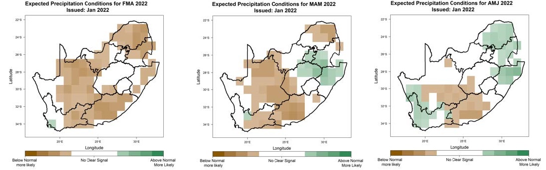 Figure 4
Figure 4: Rainfall predictions for the February-March-April (left), March-April-May (middle) and April-May-June (right) 2022 seasons.
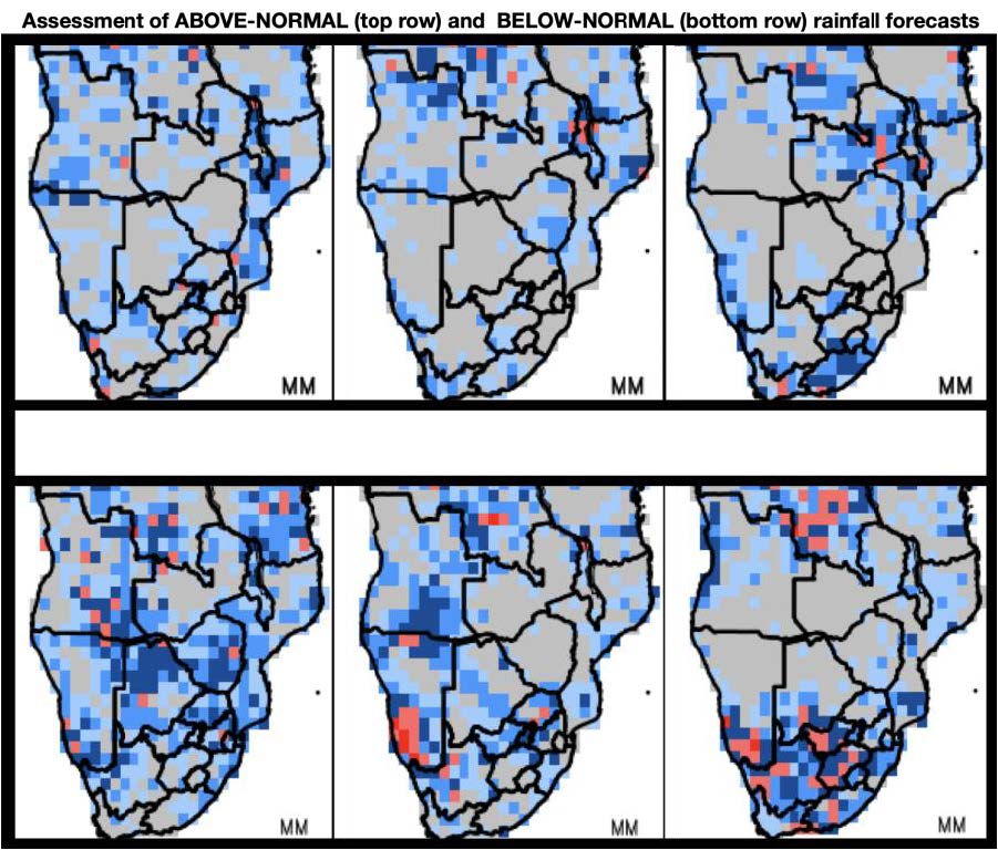 Figure 5
Figure 5: Assessment of rainfall forecasts for February-March-April (left), March-April-May (middle) and April-May-June (right) made in the month of January as represented by the Relative Operating Characteristic (ROC) curve for above-normal rainfall (top row) and below-normal rainfall (bottom row).
'We bring you the latest Garden Route, Hessequa, Karoo news'