ENVIRONMENT NEWS - If you thought a tornado in Pretoria earlier this year or rain in July was weird, hold on to your hat because the SA Weather Service (Saws) predicts a wet summer with severe storms due to a La Niña system heading to SA.
Saws scientist Cobus Olivier said its seasonal forecast reveals that summer will be hotter than normal, with rainfall patterns that are likely to favour above-normal rain.
These conditions could pose public health risks and the occurrence of natural disasters, especially flooding, he warned.
Weak La Niña on the horizon
“The El Niño-southern oscillation is in a neutral state, with rapid cooling experienced in the last month, which could result in a weak La Niña.
“For South Africa, this translates into favourable summer rainfall in the northeastern parts of the country. It is expected to increase the likelihood of flooding,” he added.
The forecasts indicate that North West, parts of the Free State, KwaZulu-Natal, and parts of the Eastern Cape will receive above-normal rain, which will benefit water reservoirs.
Drainage systems must be installed to safeguard against floods, Olivier said.
Drought risks for Limpopo and Mpumalanga
“Without proactive measures in anticipation of above-average rain, we are likely to see drownings and hypothermia.
“But for parts of Mpumalanga and Limpopo, predictions indicate below-average rain, which could exacerbate existing drought conditions.
“Farmers are encouraged to implement soil and water conservation measures, proper harvesting and storage techniques to mitigate the impact,” he added.
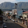
Southern Cape
While Saws predicts slightly higher rainfall in the Southern Cape for the next six months, the service says the outcomes are inconclusive and that the area may also be in for a dry spell.
Current rainfall figures are much lower than last year and the Garden Route Dam level in George is at just 65%.
READ MORE: Concerns over falling dam level
Be sure to get your George Herald this Thursday for a complete assessment of the water situation in the district by journalist Alida de Beer. You can also read her article online later on Thursday.
Warmer summer and mid-season storm surge
The seasonal forecast anticipates above-normal minimum and maximum temperatures across the country, except in the southwestern coastal areas. Saws’ lead scientist, Dr Christien Engelbrecht, said the likelihood of above-average rainfall increases towards the mid-summer period of December, January and February.
“The central part of the country, especially agricultural areas, seems to be favoured in terms of the probability of normal rainfall. However, the negative impact can include flooding and waterlogged soil,” she said.
Dam levels and storm preparedness
“The summer rainfall regions are impacted by managing the water resources in terms of dam levels, which can be due to rainfall events, leading to flooding.
“Water storage over the summer rainfall regions is already adequate, with many dams at 90% capacity, Engelbrecht said.
“The probabilities for severe thunderstorms should be higher during the first half of summer.”
Article: Caxton publication, The Citizen
‘We bring you the latest Garden Route, Hessequa, Karoo news’